Related
Related Books


Reviews
Reviews
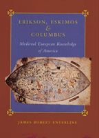
There are eighty-six items in Enterline's chronological survey, dating from Ptolemy's Geographia in the second century to Hans Poulson Resen's map of Vinland, 1605. These include maps, manuscripts, books, voyages and other events, all testifying to the breadth and inclusiveness of Enterline's research. Some will appear more convincing and pertinent than others but together they are marshaled to account for the eventual appearance of North America as a geographical entity separate from Asia... Erikson, Eskimos, and Columbus is a book worth the serious consideration of scholars interested in late medieval and early Renaissance geography and cartography.
The value of the book [is] as a source of information on medieval and Renaissance geography and the maps produced by the scholars and navigators of the period... Enterline's questing mind does not neglect problematic information, and provides reasoned and balanced interpretations of potentially valuable documents that are ignored by most surveys. For the reader who wishes a comprehensive introduction to a fascinating subject, guided by an author [with] stimulating ideas... this book is vigorously recommended.
The author argues that cartographic knowledge of northern America was in fact transmitted by Eskimos to Norsemen in the Middle Ages and early Renaissance, and that the result was subsequently incorporated in maps and charts. Enterline supports his theory by convincingly showing that parts of the coastline and contours of islands in northern Europe, as shown in early maps and charts, conform almost exactly to coastlines of northern America... He has examined pre-sixteenth century cartographic and written evidence, such as maps, charts and travel reports. He analysed and compared the images and descriptions for proof of early knowledge of the existence of the New World. The author has done this thoroughly and in a professional way... Erikson, Eskimos and Columbus is the result of thorough research, and the conclusions, if perhaps controversial to some, have been carefully considered before being written down.
Enterline presents a plausible scenario for the transmission of Thule Eskimo and Greenland Norse geographic knowledge into the worldview of late medieval cartographers. His hypothesis will be controversial and it will stimulate scholarly debate for many years to come. It is almost certainly too extreme in its claims but it also probably contains a significant core of truth. The Johns Hopkins University Press is to be congratulated for taking a speculative chance on a speculative book.
This rather controversial book takes an unusual approach to the question of the sources of geographical information on which pre-Columbian European maps of America were based... While the book is for believers, its arguments are interesting and well-presented, making it an appropriate addition to most collections.
Enterline's extensive references are well cited and he notes areas still open to interpretation. The argument proceeds logically from one point to the next and seems, to this non-specialist, to be soundly based on credible evidence. The writing style is engaging and, despite the sometimes abstruse nature of the subject matter, keeps the reader's interest.
A handsomely made book, packed with numerous well-reproduced medieval and early modern maps of the world and the North Atlantic.
One must look back almost a century to Fridtjof Nansen's In Northern Mists (1911) to find a study that probes as deeply into the question of whether representations of pre-Columbian America appeared in European-made maps... The author has provided an invaluable service to historians of discovery, geography, science, cartography, the Middle Ages, and the Renaissance in bringing all of this information together.
Of interest to anyone with a love for maps and history.
James Enterline convinced me when he presented his interpretation of medieval maps of the Arctic region.
A thorough investigation of the evidence of Norse information about the New World and how this was transmitted to Europe. Perhaps the most novel idea is that the Norse may have learned map making from the Inuit people; the most provocative is the author's discussion of the Vinland map, which in itself would make an important work. The book is logically and effectively organized, the scholarship is exemplary, and the writing style is readable and interesting.
This book belongs in research map collections, particularly those focusing on northern regions or antiquarian maps.
About
Book Details
Publication Date
Status
Available
Trim Size
7
x 10
Pages
368
ISBN
9780801866609
Illustration Description
62 halftones, 17 line drawings
Table of Contents
List of Illustrations
Directory to the Chronological Survey
Preface and Acknowledgments
Front Map
Chapter 1. Introduction
Part I: Outstanding Misunderstandings
Chapter 2. Claudius Clavus
Chapter 3. The
List of Illustrations
Directory to the Chronological Survey
Preface and Acknowledgments
Front Map
Chapter 1. Introduction
Part I: Outstanding Misunderstandings
Chapter 2. Claudius Clavus
Chapter 3. The Inventio Fortunatae and Martin Behaim
Chapter 4. The Yale Vinland Map
Part II: The Chronological Survey
Chapter 5. Introduction to the Chronological Survey
A. Classical Norse Greenland
Chapter 6. Early Scandinavian Geography
Chapter 7. Communication Links with Greenland
Chapter 8. The Unseen Bridge
B. Uncovering an America
Chapter 9. Late Greenland-Based Exploration
Chapter 10. Foundations of European Misunderstandings
Chapter 11. News Penetrates the Establishment
Chapter 12. Europe's Westward Awakening
Chapter 13. Mastery of the Atlantic
C. Old Images in New Maps
Chapter 14. A New Continent Emerges
Chapter 15. An Old Continent Emerges
Chapter 16. The Misunderstandings Are Resolved
Chapter 17. Conclusion
Appendix: The Vinland Map's Ink
Notes
Selected Bibliography
Facsimile Atlases and Reproductions
Index
